WHERE DADA QORQUD LIVED
This Azerbaijani region is just a few dozen kilometres from Baku
Author: Aynur TALIBOVA Xizi - Siyazan
The valley through which the road to Xizi passes - a short section of the Baku - Rostov highway - is really unusual: different geographic deposits give the landscape a range of colour that you won't see anywhere else. It's said to be similar to Death Valley in the USA, but don't be put off by the "life-enhancing" comparison.
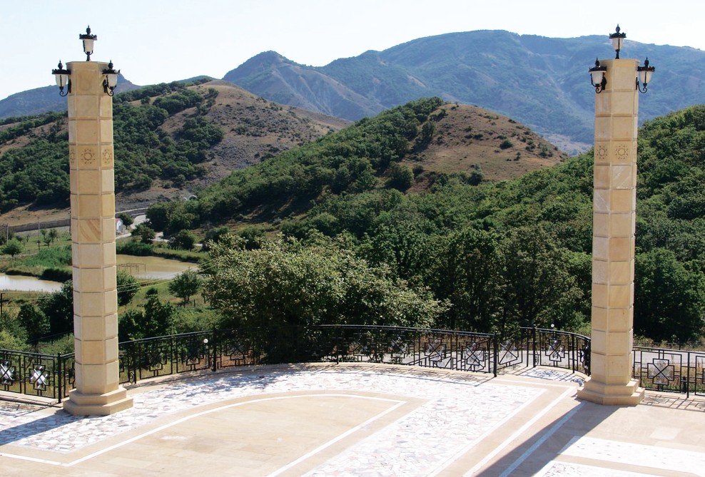
It's hard to resist going for a ride round the valley, lined with the red and gold of the Sarafat range. The mountains here are not high - the highest point is Mount Sarak, 958 metres above sea level. In some parts of the range one mountainside provides winter pasture and another summer pasture
Population
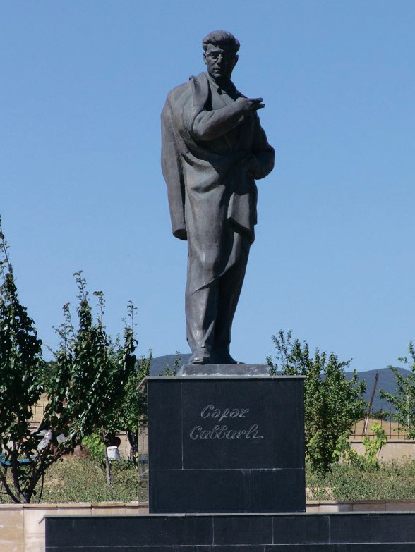
Xizi is the birthplace of outstanding Azerbaijani authors and philosophers, Cafar Cabbarli and Mikayil Musfiq, who both fell victim to the Soviet repression.
The people of this Azerbaijani district are called "dagli" - "highlanders". The local dialect is very similar to Baku's. In the 4th-6th centuries, Tats migrated to Xizi from Iran. Today some 20,000 Tats live in Azerbaijan, most of them in the north-eastern regions, including Xizi.
The names Xizi and Xazar
According to historical sources, the place name Xizi comes from the word "xazar" ("khazar"). Historian S.S. Bogush says that over several centuries the Khazars ruled the territories of the Caspian, Black Sea and Baltic Sea. Eighth century Arab historian Ibn Fadlan wrote that the Muslim part of the Turkic-speaking Khazar people was led by a representative of the Xizi tribe. The Xizi tribe lived in the northern part of Azerbaijan in the 2nd century BC. This people believed in God and the prophet Elijah.
Strabo wrote that the route to India passed through Azerbaijan, including the region of Xizi-Barmaq which is part of the Great Silk Road.
Xizi-Barmaq region
The place name Xizi-Barmaq comes from the names of Turkic-speaking tribes. Some sources even say that this was where the hero of the ancient Turkic epic, Dada (Father) Qorqud, lived. German traveller Adam Oleari visited Xizi-Barmaq and wrote that the wise man is buried here in the town cemetery, according to the people of Derbent. The traveller even visited the grave where local people said the great man lay. "The grave of Imam Qorqud was on a hill. He is said to have been a friend of the Prophet Mohammed, to have sat at his feet and studied." According to legend, Dada Qorqud lived around 300 years, much longer than the Prophet himself.
The Dada Qorqud epic also contains tales about Xizi-Barmaq region, the Oguz plateau, the Cigatay lowland and Mount Boybeim. This gives grounds to say that Dada Qorqud came from Xizi-Barmaq region.
The Barmaq tribe worked the land and worshipped fire. They retained elements of sun worship until the 7th century. From this time the people of the region began to convert to Islam. The Roman Empire's 12th Thunderbolt (Fulminata) Legion is said to have been here too.
Tourism
Today Xizi is a small district in northern Azerbaijan. The main street of the town is no more than a few hundred metres long. At first glance, the place looks rather dull. But as soon as you get out of the district centre, everything quickly changes: the local landscape is so rich that boredom vanishes.
Xalac village
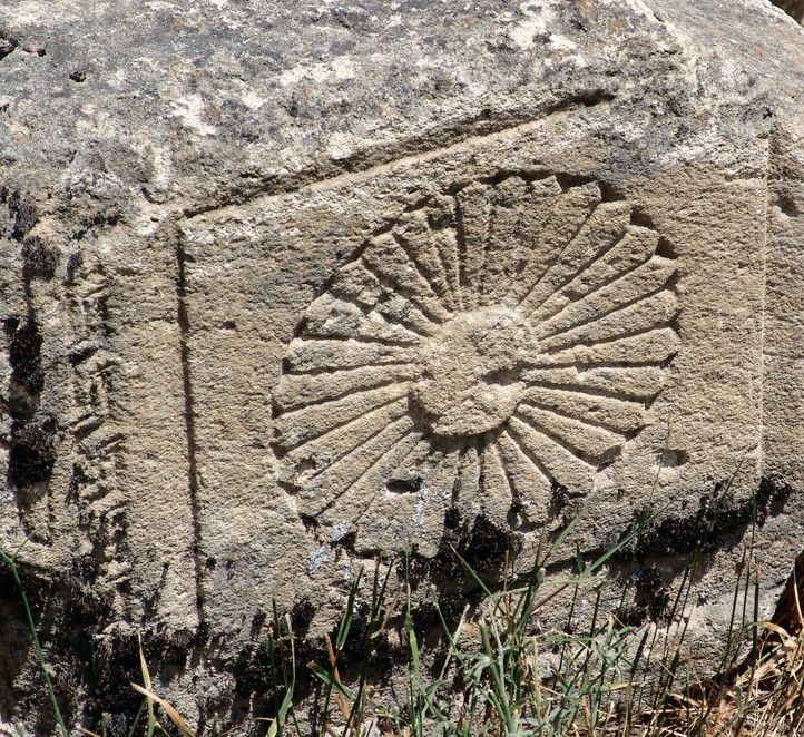
This ancient village is 4 km from the town of Xizi. The gravestones in the local cemetery still bear images of the sun - the symbol of the Safavid state. You can meet pilgrims here heading for the Ag Pir (White Shrine). The old Ag Deyirman (White Mill) is another historic monument.
The word Xalac comes from the name of an Oguz tribe. In the 12th-18th centuries these peoples took part in the conquest of the Near East. Descendants of the Xalac tribe still live in Iran and Turkmenistan. Villages with the same name exist in other parts of Azerbaijan too.
Alisirin village
This village is also called Sixlar. It has one of the most interesting of the region's historic monuments - the 15th century tomb of Sheikh Heydar, the father of Shah Ismayil Xatai, founder of the Safavid state. In 1483 and 1487 he went on two campaigns in Dagestan and Sirvan to the horror of all the rulers of the region, including Sultan Yaqub. To prevent Sheikh Heydar from further strengthening his position, Sultan Yaqub helped Sirvansah Farrux Yasar to repel him. In 1488 there was a fierce battle between the Sirvansah's combined forces and the Safavid army. Both sides suffered heavy losses, while Sheikh Heydar died in the battle. There are several stories about the sheikh's burial place. According to one, he is buried in the cemetery in the village of Alisirin (or Sixlar). Today the tomb where Sheikh Heydar is said to lie is a place of pilgrimage.
Bayaxmad Yurdu village
Ten kilometres from the town of Xizi is one of the most attractive mountain villages - Xizi-Bayaxmad Yurdu (the land of Axmad Bay). Many people link the name of the village with the name of the local bays or noblemen who lived here until the October Revolution. This village was founded in the 11th century by the Seljuk tribe Axmadli. Life here was marvellous until the Second World War, but during the war the villagers suffered famine and ruin which claimed 400 lives. The population moved to the capital and today most of the residents of Baku's famous Papanin Street (which has now been renamed) are migrants from this village.
Qizilqazma
Some 1,500-1,600 metres above sea level and 8 km from the town of Xizi is the village of Qizilqazma. The clean mountain air and enchanting landscape make this village especially attractive. It is difficult to convey in words the pleasure of travelling to this village along the modern concrete road through thick forest. The higher you go in the mountains, the lower the temperature - the difference can be as much as 8-10 degrees Celsius. The shores of the mountain lake, dotted by luxury villas, are even cooler. Qizilqazma is a spot where you can hide from the heat of summer, relax from the noise of the city and enjoy the natural beauty.
Altiagac
One of Azerbaijan's best known tourist areas, the village of Altiagac, is 12-14 km from Xizi, where Quba, Siyazan and Samaxi districts meet. In the Middle Ages, during the Sirvansahs' state, the road from Samaxi to Quba passed through here. This gave the village its name - Altiagac - which translates from Azerbaijani as "Six Trees". At one time, an "agac" or "tree" was considered a unit of length, equivalent to 7 km. The distance from Samaxi to Altiagac is 42 km, or six trees. In order to determine the length of a stretch of road, a tree would be planted every 7 km as an indicator.
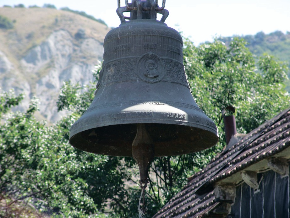
At one time Molokans lived in this village, resettled by the tsarist government to Samaxi District. The Molokans are a Christian sect. By resettling them, the tsarist government tried to prevent schism in the Orthodox Church. The large bell of the local church and wooden Russian cottages still remain in Altiagac. Today these houses are rented out to tourists.
The villagers mostly keep livestock. Altiagac also used to be known for its apple orchards. A rope way leads from the village to the forest between the mountains. This is an ideal spot for picnics. In the summer Altiagac is a favourite place for people with respiratory problems. Hikers can walk from here to Samaxi.
The National Park office is at the entrance to Altiagac. Altiagac National Park, 120 km from Baku, has been set up on the basis of the nature reserve of the same name and covers Xizi and Siyazan districts. Some 90 per cent of it is wooded. The park is home to nine species of animal and 12 bird species that are on the endangered list.
Soyuqbulaq
Altiagac National Park has all the facilities necessary for ecotourism. The hamlet of Soyuqbulaq, which has a huge number of springs, is at the highest point of the park, surrounded by thick forest. The springs give the hamlet its name, which translates as Cool Spring. Park staff say that if you are quiet, you may see some of the local animals. They are protected so they live side by side with people. So if you are thinking of camping overnight, you've got nothing to fear. Just remember to get permission from the administration as you enter the park.
Siyazan
There's another stop, just as interesting on the Quba - Xacmaz route, Siyazan. This district isn't flush with tourist sites but it does have at least two historical monuments that are well worth a visit. One of them is the symbol of Siyazan District, Besbarmaq fortress wall, and the other is the fortress wall of Gilgilcay, which has been linked with the Great Wall of China.
Besbarmaq
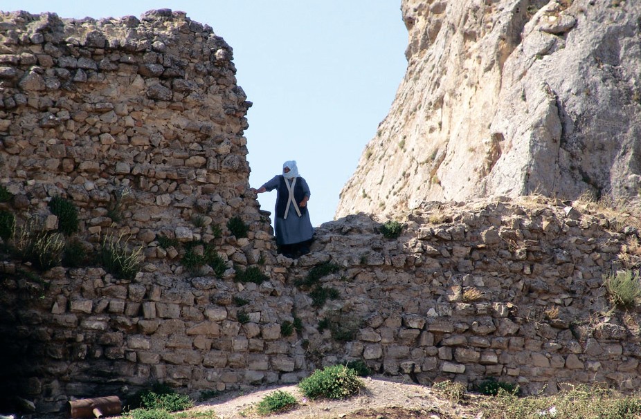
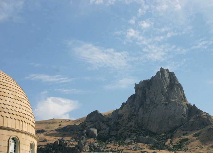
The ancient fortress of Besbarmaq and the shrine of the same name are 90 km from Baku on the Baku - Rostov highway on the south-east slopes of the Greater Caucasus. It is busy here at any time of year - pilgrims stream to the shrine during the frosts of winter and the heat of summer. The cliffs at the top of the mountain look like a human fist and catch the eye from a long way away. This is the Besbarmaq shrine where pilgrims come to bring offerings, seek the mercy of the Almighty and be cleansed of their sins. The name Besbarmaq (Five Fingers) is linked with the appearance of the cliff, which resembles a human fist. There is another interpretation of the name. The toponym is said to come from the ancient Turkic word "parmak" which means "mountain-top residence". This is the first local place name found in the work of 9th century Arab traveller Al-Masudi.
Legend has it that the famous "Huns' Gates" began here. The fortress walls, caravanserai and other buildings at the top of the mountain were built by Alexander the Great and subsequently destroyed by the forces of Tamerlane.
Shrine
It's very difficult to be specific about Besbarmaq's history. It's known that in ancient times Besbarmaq mountain was a place of worship for the people of Caucasian Albania. This is how German traveller Adam Oleari, who visited Azerbaijan in 1636-38, described what he saw: "A woman was guarding the tomb (in the shrine). On the day that offerings were made the shrine was covered in carpets. Many women and girls came here from the town and distant districts. They took off their shoes, entered the cave, kissed the tomb and sat nearby to pray that their wishes might come true. When they had finished their prayers, the women gave the temple guard food that they had brought with them. She spent the night here so the pilgrims brought her bread, cheese, milk, wine and butter. That night different cries and sounds could be heard from the graveyard of the saints. It was all reminiscent of idolatrous rites."
Today Besbarmaq is one of the best known holy places in Azerbaijan and the subject of many legends. According to one, the Prophet Khizir, who was a contemporary of Alexander the Great, became immortal when he drank the living water (zinda) in the dark cave on Besbarmaq mountain. Since then it has been called Khidir-Zinda or Khizir-Zinda (immortal Khizir). Believers think that this was where the prophets Khizir and Moses once met. This can be found in the work of 9th century Arab scholar Ibn Hordadbeh.
Another legend has it that five brothers once settled on this mountain. One day the oldest brother, Xizir Zinda, sent his younger brothers Xizir Nabi and Xizir Ilyas for water. Three days passed but there was no sign of the brothers. Xizir Zinda was furious and cursed them: "May you turn into stone!" And the younger brothers turned into the rocks in the Caspian. They are said to be the two cliffs in the water opposite Besbarmaq.
According to mythology, the image of Khizir is mainly linked with fire, warmth, harvest and the revival of nature after the winter. Despite the dominating role of Islam in modern-day Azerbaijan, elements of early religion are maintained in the people's world view, although Muslims try to adapt to Islam the rites and traditions of worship at this shrine.
As for the fortress wall, which crosses Besbarmaq mountain, 7th century geographers call it the Xors-Van wall. Research shows that this fortress separated Sirvan region from the country of Xursan.
Fortress
Seventeenth century Dutch traveller and seafarer Van Streis wrote: "At sea we saw a mountain. It was called Parmakh or Barmakh. The top of the mountain looked like an outstretched index finger. There was once a magnificent fortress here, which defended these territories. The foundations of this fortress and its stone well have been preserved to this day."
Besbarmaq fortress is the first building in a defensive system built in Caucasian Albania. The fortress wall ran from the mountain to the Caspian Sea. Albanian historian Musa (Moses) Kalankatli said the fortress was built by Sassanid ruler Yazdegerd in 438-457.
The Sassanids waged periodic campaigns in the South Caucasus, trying to extend their territory. However, the Albanian rulers' fierce resistance and attacks in response forced the Sassanids to build a whole network of castles, including Besbarmaq and Gilgilcay, 27 km away.
This castle is mentioned by 13th-century French traveller William Rubruck.
Gilgilcay fortress
Researchers studied some 60 km of ruined walls from this fortress, buried in earth, in 1931-32 and 1963-64. According to Ardabil sources, Sassanid ruler Kavadh (488-531) laid the foundations of Sur et-Tin Fortress (clay wall). The fortress wall runs from the sea to Babadag mountain.
The first reports about the fortress can be found in the book The Conquest of Lands by 9th century Arab historian Al-Baladhuri. He writes that the son of Firuz, the Sassanid shah Kavadh, sent 20,000 troops against them (the Khazars). Then Kavadh himself joined them and built the wall of unfired brick between Sirvan and Aran.
Abasqulu aga Bakixanov writes in his work Golestane Eram (The Blooming Flower Garden) that Gilgilcay fortress wall begins at the sea, joins Ciraqqala fortress and from there heads towards Babadag mountain via Anta mountain.
RECOMMEND:
 959
959